Barsetshire map
A3 (297 x 420mm) colour printed map (Out of stock)
A4 (210 x 297mm) colour printed map
Free postage within the UK
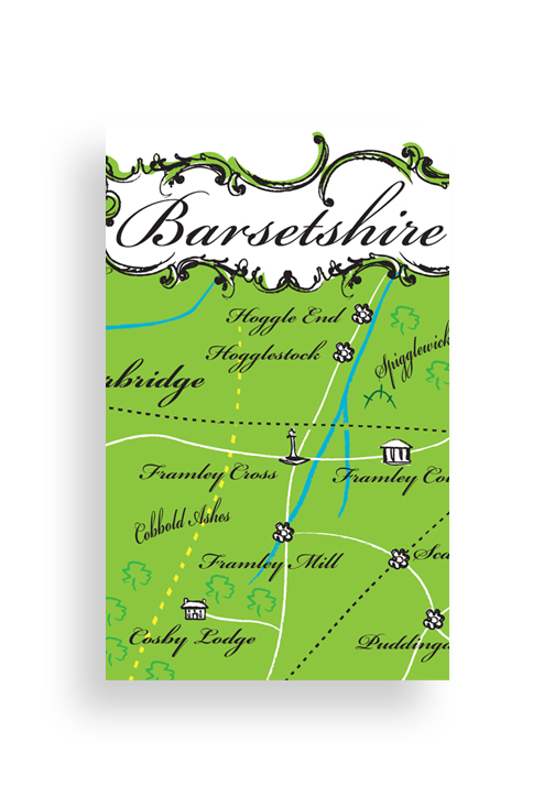
Specially commissioned by the Trollope Society, this new map of Barsetshire has been created to be as accurate and true to Trollope’s original intentions as possible. Every geographical reference in every novel has been considered, and where anomolies arose the most reasonable solutions have been adopted. The result is the most comprehensive map of Barsetshire ever created, beautifully illustrated by Simon Grennan.
As I wrote Framley Parsonage, I became more closely than ever acquainted with the new shire which I had added to the English counties … The was the fourth novel of which I had placed the scene in Barsetshire and, as I wrote it, I made map of the dear county.
Anthony Trollope, An Autobiography
Based on the 2018 map created for a limited edition tea-towel, this printed version sees the attractive vignettes moved to the border of the map, new symbols devised, and the text reduced in size in order to enable us to replace landmarks and locations that had had to be taken out for the tea-towel.
The Society is delighted to have finally created what we hope will be the most accurate and definitive version of ‘The Beloved County’ to date and, of course, continue to be grateful to those few cartographers of the past who have worked so hard on the same problems. We hope that it will be enjoyed by all Trollope enthusiasts.